Let me start with something that happens on renovation projects more often than anyone likes to admit.
The project team receives existing drawings for a building. They look reasonable enough. Floor plans, sections, and structural layout are all included. Someone surveyed this building at some point. The team then starts designing based on what those drawings show.
Then someone goes to the site.
The wall the architect designed is 60mm thicker than the drawing shows. The column shown in one position sits 300mm further north in reality. The ceiling void the MEP engineer depends on is 200mm shallower than the section indicates. A beam was added during a previous renovation, but no one updated the drawings.
The design work done before that site visit is now unreliable. Some parts need rework. The project is already behind, even before the main contract starts.
This story is not unusual. It happens on almost every project involving an existing building of any age. Drawings and reality slowly drift apart over time. The gap only becomes visible when someone measures what actually exists.
Scan to BIM exists to close that gap before design work begins, not after problems appear.
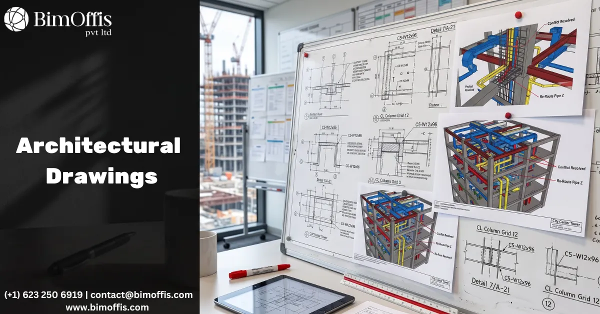
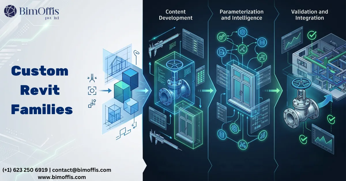
What Scan to BIM Actually Is
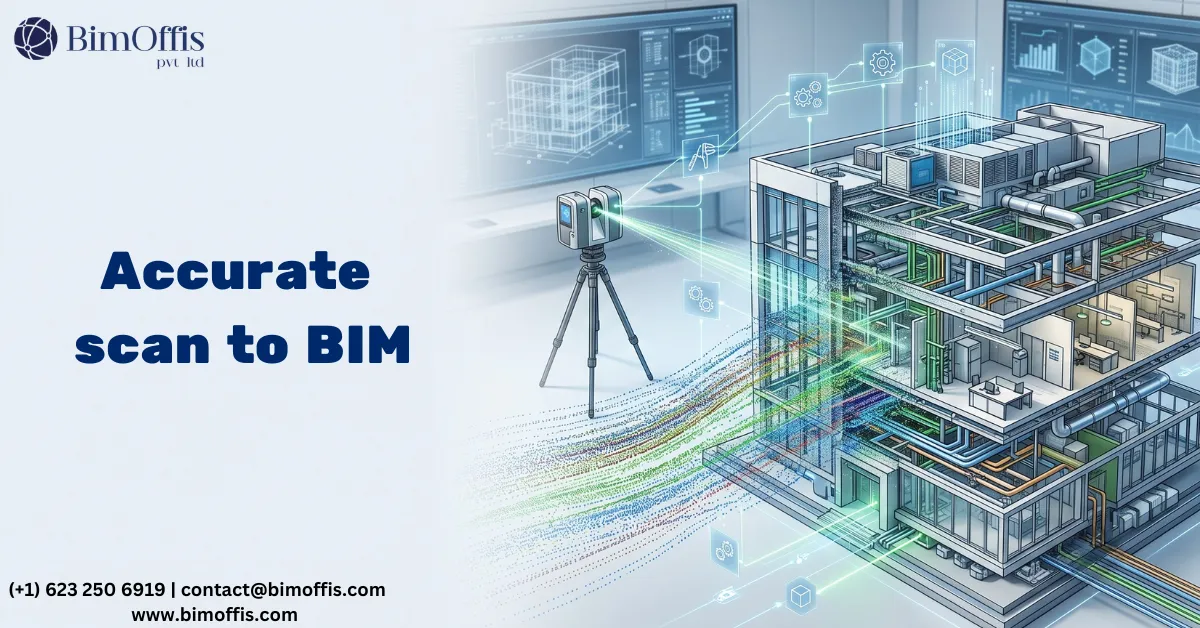
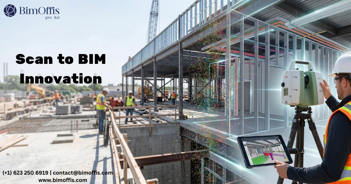
Scan to BIM is the process of capturing an existing building using 3D laser scanning technology and turning that data into an accurate BIM model.
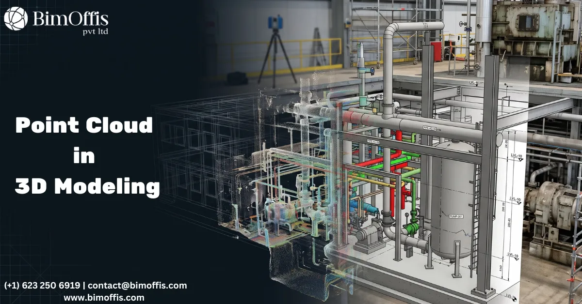
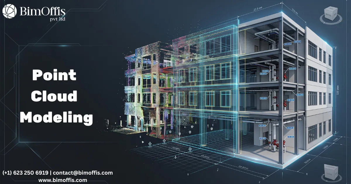
A laser scanner sits in a space and sends laser pulses in all directions. Each pulse hits a surface and returns to the scanner. The device calculates distance based on return time. When you repeat this from multiple positions, you get a complete three-dimensional point cloud. This point cloud contains millions of data points that represent the real space with millimeter-level accuracy.
The point cloud is not the BIM model. It is raw reality data of the building as it exists today.
Modelers then use this point cloud as a reference. They trace walls, floors, columns, beams, MEP systems, and other elements directly from it. They build the BIM model based on actual measured conditions.
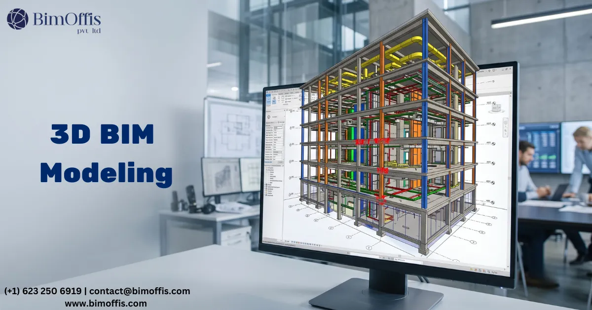
The final output is an as-existing BIM model. It reflects the building exactly as it stands today, not how it was designed or previously documented.
Why Scan to BIM Matters in Real Projects
It Removes Survey Errors That Affect Design
Here is what a traditional measured survey usually involves.
A surveyor visits the site and takes manual measurements using laser tools. They sketch layouts, note dimensions, and mark positions on drawings. Later, they return to the office and convert those notes into drawings.
Even with experienced surveyors, this process introduces errors. Dimensions can get transposed. Heights can be misread. Some elements get missed due to limited visibility. Build-ups may get estimated instead of measured. Past modifications can also be overlooked.
These small errors do not stay in the survey. They move directly into the design.
An architect may design based on slightly incorrect dimensions. An MEP engineer may route services through spaces that are actually tighter than expected. On site, the contractor then discovers that the design does not fit the real building.
Scan to BIM removes most of these issues. The laser scanner captures the building fully and consistently. It delivers a much higher level of accuracy than manual surveying.
The BIM model built from this scan reflects real conditions. The design team works from reality, not assumptions.
It Handles Complex Buildings Better Than Traditional Surveys
Some buildings are extremely difficult to measure using traditional methods.
This includes industrial facilities filled with dense equipment, pipework, and structural steel. It also includes heritage buildings with irregular geometry and non-standard construction. Many buildings have also been modified multiple times without proper records.
In these cases, manual surveys often capture only the general layout. They miss critical detail due to access limitations and complexity.
Scan to BIM captures everything. It records every surface, pipe, beam, and structural element in three dimensions. It does this with high completeness and consistency.
This level of detail changes how confidently design teams can work with existing conditions.
Where Scan to BIM Is Used
Heritage and Conservation Projects
Many heritage buildings have incomplete or missing drawings. Some originals no longer exist. Others do not match the building after decades of changes.
Scan to BIM solves this problem by capturing the current physical condition of the building without touching the structure. The scan records every detail accurately.
The resulting BIM model becomes the design reference for conservation and renovation work. Architects and engineers can then plan sensitive interventions based on real geometry.
Industrial Retrofit and Plant Modifications
Industrial environments are among the most complex spaces to survey. Equipment, piping, and services are tightly packed. Access is often limited. As-built documentation is frequently outdated or incomplete.
Scan to BIM captures the full condition of these facilities. It shows exactly what exists and where it is located.
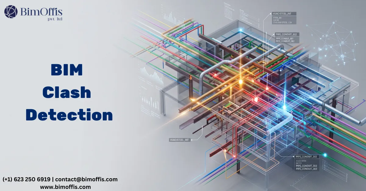
This helps teams coordinate new installations with existing systems before work begins. It reduces clashes, avoids rework, and minimizes costly downtime.
In industrial projects, mistakes discovered during construction are extremely expensive. Scan to BIM reduces that risk by improving design accuracy upfront.
Commercial Renovation and Fit-Out
Commercial renovation and fit-out projects rely heavily on accurate existing condition data.
Tenants, developers, and building owners need to understand the space before design begins. Traditional surveys often introduce uncertainty that leads to conservative design decisions.
Scan to BIM provides a reliable BIM model of the actual space. Designers can work with confidence and reduce safety margins caused by uncertainty.
This leads to better coordination and fewer surprises during construction.
BIM model outputs from scan data give teams a strong foundation for renovation work.
What Needs Careful Management
Scan to BIM is powerful, but it still requires proper handling.
Point cloud data is large and heavy. It requires strong hardware, efficient workflows, and proper file management. Teams should avoid working directly with full raw datasets without structure.
Model quality also depends heavily on the skill of the BIM modelers. A good scan does not automatically produce a good model. Experienced teams interpret point clouds more accurately and produce cleaner BIM outputs.
Scope definition is another key factor. Teams must clearly define what needs to be modeled, at what level of detail, and for what purpose. Without this clarity, projects often face rework and delays.
The Bottom Line
Scan to BIM is changing how the industry works with existing buildings. It solves a real and persistent problem: unreliable existing conditions data.
When existing information is accurate, design work becomes more predictable. When it is not, problems appear during construction when they are hardest and most expensive to fix.
Teams that use scan to BIM consistently report fewer site issues, better coordination, and more reliable project delivery. It reduces uncertainty and improves confidence in renovation and retrofit work.
Ready to convert your laser scan data into an accurate BIM model? Get your free project estimate today.
Frequently Asked Questions from Clients
What is scan to BIM?
It is the process of capturing an existing building with 3D laser scanning and converting that scan data into an accurate BIM model reflecting actual site conditions.
What is a point cloud?
A dense three-dimensional map of millions of data points captured by the laser scanner, representing every visible surface of the building with millimeter-level accuracy.
Why is scan to BIM more accurate than a traditional survey?
A laser scanner captures the building comprehensively at millimeter accuracy, while traditional surveys depend on human measurement that consistently introduces errors carried forward into the design.
Which project types benefit most from scan to BIM?
Heritage buildings, industrial retrofit projects, and commercial renovations benefit most because their existing conditions are too complex or too inaccurate in existing drawings for traditional surveys to capture reliably.
What is the biggest risk in a scan to BIM project?
Vague scope definition before work starts, without clearly defining what needs modeling, at what LOD, and for what purpose, the model rarely serves the project as well as it should.
Does scan quality automatically mean model quality?
No, a high-quality scan still produces a poor model without experienced modelers working with the point cloud data, because the modeling expertise matters as much as the scanning technology.